Lower Maumee River Sediment Remediation Project

Portions of the Lower Maumee River are getting cleaned up. What does this mean for the Toledo community?

About the Project Click here to see PROJECT updates. 

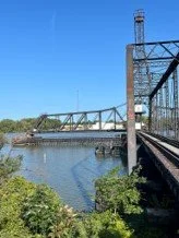
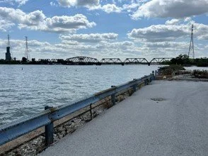
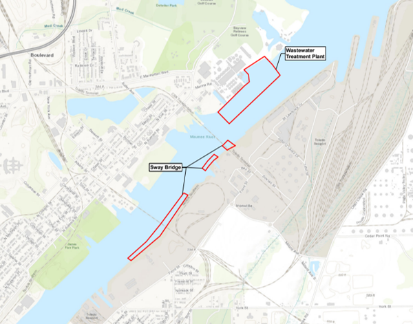
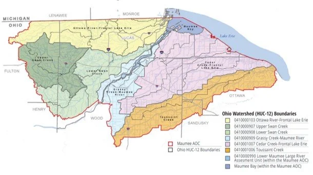
The Lower Maumee River Sediment Remediation Project is an environmental cleanup project that will take place at two locations within the Lower Maumee River: the Sway Bridge and the Wastewater Treatment Plant (WWTP) at the Toledo Water Reclamation Facility (see photos 1-3 and map). The cleanup will remove pollution from the river to benefit people, aquatic life, and the ecological system.  Overall, the cleanup will remove contaminated sediments across 42 acres in the Lower Maumee River. The site is in the larger Maumee Area of Concern, designated by the U.S. Environmental Protection Agency as a priority area for restoration in the Great Lakes region (photo 4). 

How is the river affected in these areas? 

  • Historical operations- Years ago, industrial and commercial operations along the shoreline of the Lower Maumee River caused chemicals to make their way into the water and eventually settle into the river bottom sediments where they can impact plants and animals.  

  • Chemicals in sediment- The main chemicals of concern are heavy metals, polychlorinated biphenyls (PCBs) and polyaromatic hydrocarbons (PAHs). These are found in sediments at the sites in concentrations above levels that have been determined to be safe for people and aquatic organisms.  

  • Heavy metals can be naturally occurring, but human activities increase amounts present in ecosystems. Large amounts can cause health issues for people and aquatic life.  

  • PCBs and PAHs are man-made chemicals that were mostly used prior to the 1980’s and break down slowly so they remain in sediment and soil for a long time.  

How will the pollution be removed and where will it go? 

The project partners are working with a design team to develop a cleanup plan for the sites. The plan will be developed in coordination with the cleanup alternative recommended by the U.S. Army Corps of Engineers in 2023. To learn more about this and other previous studies for these areas, go to Previous Studies below. The team is currently in the field doing sampling and surveys as part of a Pre-Design Investigation. To learn more, see Project Updates below.  

The details on exact methods used to remove contaminated sediments and where the sediments will go are still in development. However, it is likely that removal of sediment via dredging will be used at both the Sway Bridge and WWTP areas. Dredging involves removal of the sediment using various types of equipment. For this project, mechanical dredging using excavator-style equipment is being considered (S1_5).  Mechanical dredging is used throughout the Maumee and other Great Lakes AOCs to safely remove contaminated sediment.  Where the sediment will go once it is removed from the river is still being determined. One option may be to safely transport the material to the Toledo Harbor Confined Disposal Facility operated by the USACE to contain sediment from other cleanup projects.  

Who is funding this project and who are the project team members? 

The project is being performed under a cooperative agreement between the U.S. EPA Great Lakes National Program Office (USEPA GLNPO) and the Ohio EPA. The USEPA GLNPO provides funding for the project under the Great Lakes Restoration Initiative (GLRI). Funding will be provided to the Toledo-Lucas County Port Authority to carry out the project and lead the Project Management Team which includes the City of Toledo, Ohio EPA, USEPA GLNPO, and USACE Buffalo District (S2_1). 

Why is this cleanup important to the community? 

The Lower Maumee River sites have Beneficial Use Impairments (BUIs) in place. A BUI represents a condition in the river that is environmentally degraded. For example, a BUI of Loss of Fish and Wildlife Habitat means that the ecosystem in that area conditions (either physical, chemical, biological, or a combination) necessary to support fish and wildlife have been degraded and habitat improvements are needed. For this project, five of the fourteen BUIs have been designated (S3_1).  When the cleanup is completed, the BUI can be considered for removal, which can contribute to desilting of the Maumee AOC when considered with other completed cleanup projects (S3_2). The cleanup of the river will benefit the local community by restoring the ecosystem to support a healthy aquatic and terrestrial environment. 

List of the BUIs currently designated for the Lower Maumee River.

List of the BUIs currently designated for the Lower Maumee River.  

Scenic views of Toledo.  

Process by which BUIs are identified, actions determined that would address those BUIs, and eventual BUI removal.  

What are the major steps in the project process and what is the schedule? 

Please note that the timeframes indicated for each major step (in the graphic) are estimated and will depend upon many factors. Please check back regularly for any updates. 

  1. A Feasibility Study is undertaken to determine the best options for cleaning up the sites. From those options, one is selected as preferred to carry out the cleanup. 

  2. Pre-Design Investigations (PDI) occur on the site to gather important information about the sediment to be cleaned up and the surrounding environment.  

  3. Using information collected during the PDI and from any previous studies, the Design process begins and the specifics of the cleanup methods are developed.  

  4. During the Design process, Public Information Sessions are held to provide information on the cleanup plan progress and seek input and questions from the community.  

  5. Permitting is carried out starting mid-way through the Design process. Important agency consultations are also completed during this timeframe, and earlier as appropriate.  

  6. The Final Design is completed and all permits are received. Once funding is obtained, the cleanup is ready to begin! 

When and how can the community get involved? 

The public will have opportunities to get information on the project, provide comments and ask questions to the project team. So far, the following opportunities will be available: 

  • Public Information Session #1 (targeted time February/March 2025) 

  • Public Information Session #2 (targeted time May/June 2025) 

Check back regularly as information on these sessions will be posted closer to the events.

For more information, please click the links below.

City of Toledo

Great Lakes Restoration Initiative (GLRI)

Maumee Area of Concern (AOC)

Ohio Environmental Protection Agency

United States Environment Protection Agency Great Lakes National Program Office

United States Army Corps of Engineers

Additional questions? Contact us today by emailing contactus@toledoport.org.

Project Updates  

Keep up to date on the latest in planning for this project. Currently, Pre-Design Investigations are underway! Check back frequently for more updates.  

Pre-Design Investigations 

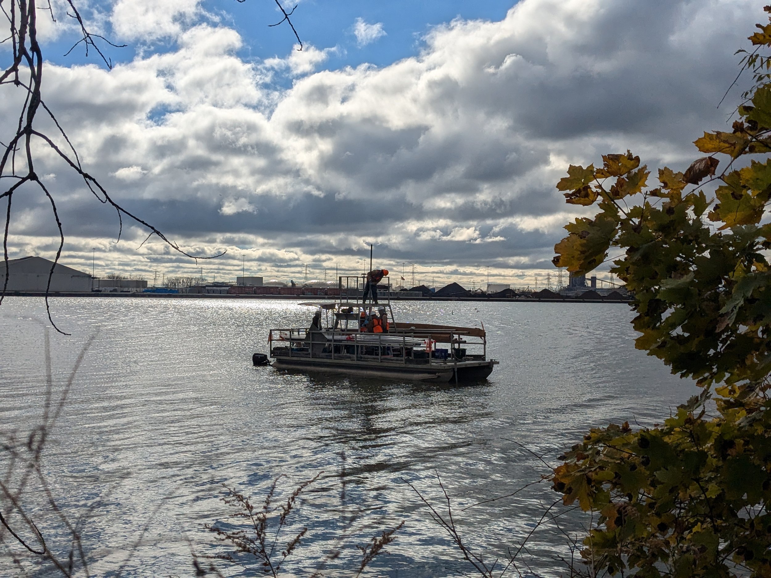
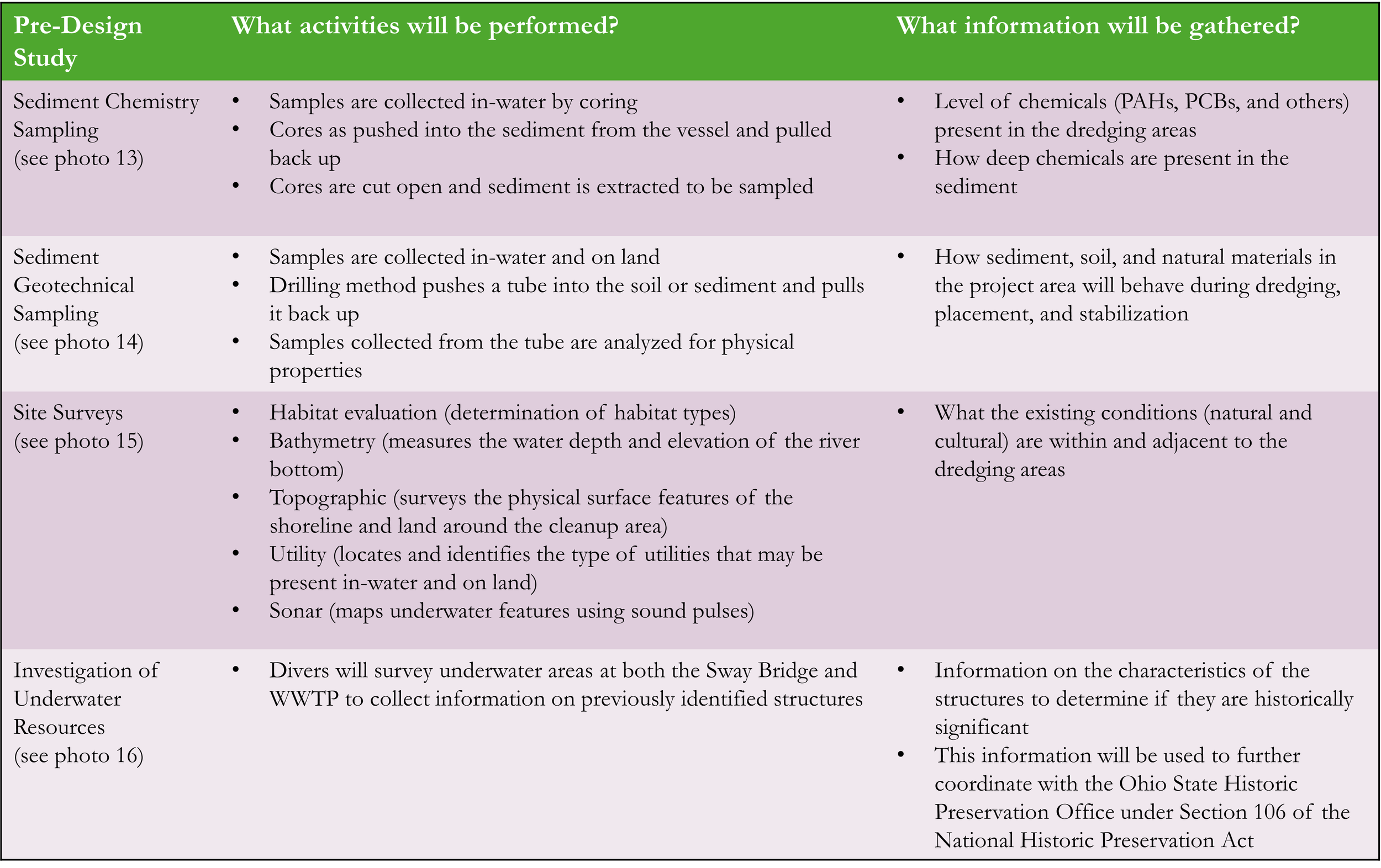
To support development of the design (plan for the cleanup), the project team is performing sampling and surveys during November and December 2024. During these investigations, the team gathers important information that helps to select cleanup methods necessary to meet project goals, and work in harmony with natural and cultural resources within the cleanup areas. See below for photos of current work and descriptions of the activities. 

Sediment Sampling 

Two types of sediment samples are being collected on the sites: 

Chemistry samples 

  • Chemistry samples will indicate what level of chemicals (PAHs, PCBs and others) are present in the areas to be dredged and how deep these chemicals are present in the river bottom 

  • These are collected in-water by a process called coring.  

  • Cores (long, lined, rigid plastic tubes) are pushed into the sediment from the sampling vessel and pulled back up (LP_PDI_1_Sediment coring).  

  • Cores are then cut open and sediment is pulled from specific portions to be sampled. 

Geotechnical samples 

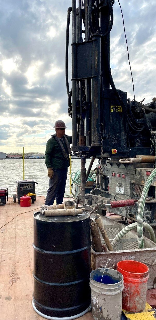
  • Geotechnical samples are collected to inform how sediment, soil, rock and natural materials that will be removed as part of the cleanup will behave during dredging, when placed in the CDF, or when stabilization actions are necessary during the cleanup. 

  • These are collected in-water and on land using a drilling method suitable for both environments that pushes a tube into the soil or sediment and pulls it back up (LP_PDI_2_Geotech). 

  • Samples are then collected from the tubes and analyzed for physical properties.  

Site Surveys 

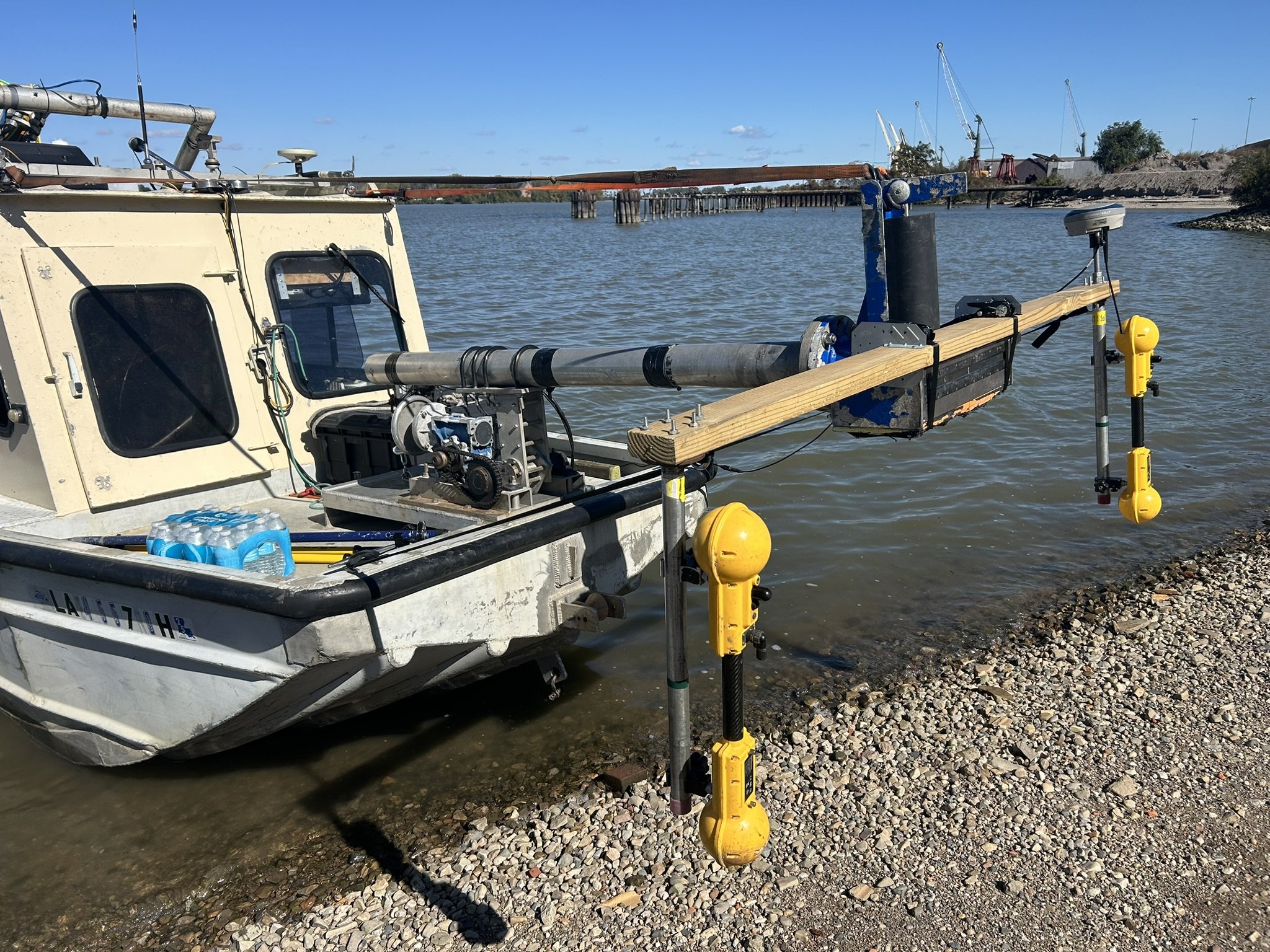
Many site surveys are being performed in the cleanup areas, both on land in in-water. The surveys gather important information about other existing conditions of the river and shoreline that helps inform the cleanup plan. These surveys include (LP_PDI_3_Sonar): 

  • Habitat evaluation (determination of habitat types) 

  • Bathymetry (measures the water depth and elevation of the river bottom) 

  • Topographic (surveys the physical surface features of the shoreline and land around the cleanup area) 

  • Utility (locates and identifies the type of utilities that may be present in-water and on land) 

  • Sonar (maps underwater features using sound pulses) 

Investigation of Underwater Resources 

The cleanup of the Lower Maumee sites is federally funded and will require federal permits to complete the work. Consultation with the Ohio State Historic Preservation Office (SHPO) is required (as part of the National Historic Preservation Act, Section 106) to determine if any eligible historic or culturally significant resources are present in the clean-up area.  

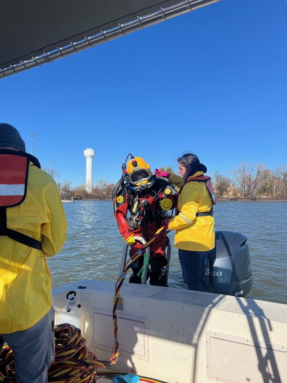
As part of this, divers were deployed at both the Sway Bridge and WWTP areas to collect information on previously identified structures present on the river bottom. This data will be used to determine what the structures are and if they have features and characteristics that make them historically significant (LP_PDI_Divers 106).  

This information will be used to further coordinate with Ohio SHPO.  

Check back for new updates!

History of the Maumee River and the Port of Toledo 

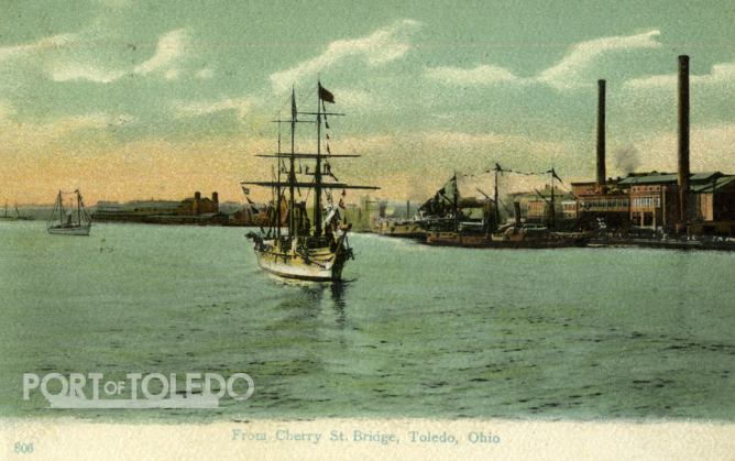
Learn about the history of the Maumee River, Port of Toledo, and industry in the Lower Maumee River.  

  • The Maumee River has the largest watershed of any Great Lakes River (8,316 square miles). 

  • The Maumee River was a historically important as a water transportation route by Native Americans, and as hunting, gathering, and farming territory.  

  • Today, the Maumee River is used as a water transportation corridor for commercial freight entering and leaving the Port of Toledo.  

  • The Port of Toledo on the Lower Maumee River has been utilized since the mid-1800’s and has been historically important in the Great Lakes region, facilitating commerce before railroads and highways existed. The Port still serves an important role today in the industrial and agricultural heartland of the United States.  

  • The Port of Toledo handles over 27 different bulk commodities, including iron ore, coal, and grain, along with gravel, sand, salt, wheat, limestone, oats, soybeans, maize, coke, abrasives, fertilizer, cement, molasses, benzene and scrap metal.  

  • The Port also has waterfront plants that make repairs to various size vessels, and houses tug operations for towing, docking and shifting vessels within the harbor.  

  • The Toledo-Lucas County Port Authority (TLCPA) offers short-term and long-term dry storage space, as well as open storage areas for commodities shipped throughout the port.  

Previous Studies  

Access the previous studies and data collected by agencies to support this cleanup.  

Previous Work Supporting the Lower Maumee River Cleanup